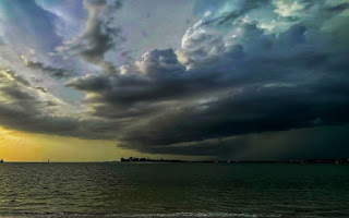
Summer in St. Pete is notorious for the evening storms. It’s what makes Tampa Bay one of the most intense areas for lightning in the world. However, this summer was different, being the hottest and most rainfall-intense one on record. According to a station at Tampa International airport, over 48 inches has fallen from June to September 10th, 21 inches more than normal. On September 4th nearly five inches of rain fell at Bear Creek in St. Petersburg, Florida in an hour, almost half of what fell during the entirety of Hurricane Debby.
This obviously does not come without flooding issues. Take Shore Acres for example, which has become a joke among many Pinellas County students for its extreme flooding, even on bright and sunny days. Flooding scenes like the one in Hurricane Debby became normal for the latter part of August. Roads would be close to impassable after 30 minutes in a heavy storm. However, this August St. Pete started to have similar problems elsewhere even in more elevated areas. Sophia Blaine from Hollins High School who lives well inland said that her “street only started flooding this year” and that “it floods every time” a storm occurs now. She would often see “all sorts of things running through the flooding like a river.” Countless videos of cars stalling in high waters circulated for the past month as the storms kept coming. According to the Tampa Bay Times, many city workers have not seen flooding to this extent in the entirety of the city.
The thing is, the city has grown since then. When areas have more concrete and less natural soil the water can often have a hard time figuring out where to go, especially with drainage systems that are overwhelmed, even the systems well inland. Shore Acres is a great example of this. Larger houses with much less greenery have been more prevalent, and often the rainwater could not be absorbed, causing flash flooding in as little as 10 minutes with these heavy storms. Lots of videos of this heavy flooding would often be in commercial areas with endless parking lots, like downtown. Stormwater systems in St. Pete have been in service for many years, and were built to absorb 7.5 inches of rain in a day — not 5 inches in an hour.
This summer has broken records for heat, and the humidity has consistently been at 70-90%. This is a buffet of moisture and energy for big storms to blow up quickly. This hurricane season can partially take the blame, as hurricanes often bring in dry air for a week or so and allow things to cool down. With only Hurricane Debby striking in the middle of summer there was almost no relief from this pattern. Additionally, rainfall can create more complications, the soaked ground heats the rising, moist air, feuling storms. The steaming hot gulf provides fuel for these storms, and when a front stalls in the gulf, it supercharges huge blobs of storms. This creates a pattern that resonated for almost a month with a high-pressure system causing warm winds from the Atlantic to come across a steaming hot Florida.
The development of St Pete could be supercharging these storms too. With more and more concrete buildings across Pinellas County, there is more heat absorbed, warming the air and causing the heat to rise and create storm opportunities. This hotspot allows intense storms to spawn quickly over the middle of the county in as little as 30 minutes. The urbanization of Pinellas County can cause storms and intensify, which explains why this city has been Atlantis for almost every afternoon this school year.


